
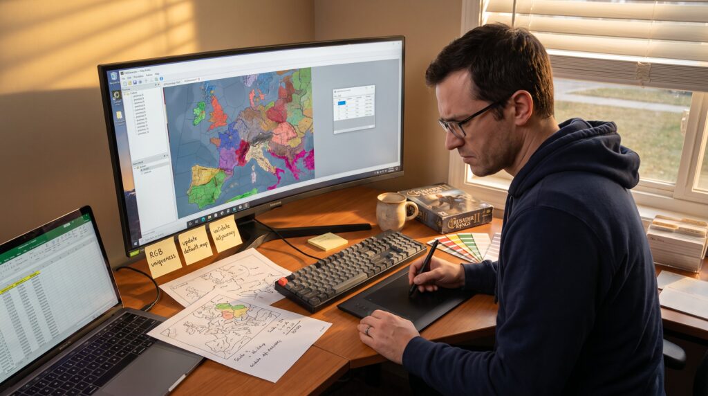
CK2Generator Map Creation: Continents, Provinces, and Political Borders is a practical how-to for building playable Crusader Kings II maps. It starts with a clear workflow, then shows how to shape continents, tune biomes, and tie provinces to in-game economy and politics. Readers will get concrete steps, load paths, file names, and file types, plus realistic tips drawn from real modding mistakes and fixes. The goal is one confident run-through that takes a generator seed to a tested CK2 mod.
Table of Contents
ToggleKey Takeaways
- CK2Generator enables efficient creation of playable Crusader Kings II maps by following a clear workflow that includes setting directories, generating landmasses, tuning biomes, and exporting required files.
- Choosing the right map scale and province count is crucial, as it directly impacts gameplay experience, performance, and political complexity within the game.
- Using heightmaps imported at mid-resolution helps achieve realistic continent shapes and mountain chains, while careful adjustments prevent geographic inaccuracies like inland seas or faulty river flows.
- Provinces must be painted with unique colors and appropriately sized in provinces.bmp, with the definition.csv ensuring proper linkage to gameplay elements like terrain, rivers, and topology for balanced AI and player interaction.
- Iterative editing and testing of biomes, coastlines, and province layouts improve both visual appeal and game mechanics, helping transform the map from a simple landmass into an engaging medieval world.
Quick Tool Tour And Recommended Workflow
Quick answer: Load CK2Generator, point it at the CK2 folder, choose Create a new map, then use Generate, Draw, or Heightmap and finish with Generate Full. This sequence produces the map files and a ready-to-test mod.
Start with the basics: set the CK2 game directory and a unique map name so exports don’t overwrite existing mods. In practice, they often forget the path and get errors: saving that step avoids wasted time. Use Draw when you want deliberate coastlines and mountain ridges. Use Generate with a seed when speed and surprise matter. Use Heightmap to import real-world relief, this is the only reliable way to get realistic mountain chains without hand-drawing.
Concrete workflow: 1) Set directory and name, 2) Pick map size and province count, 3) Generate landmasses or import a heightmap, 4) Smooth coasts and add mountains, 5) Configure climate/biomes, 6) Run Generate Full to produce default.map and definition.csv. The in-tool preview shows the final province layout before files are written.
For an example guide that walks through one-click and manual options, see a step-by-step writeup on CK2Generator.com: Create Epic Random Maps. This article helped the author avoid a common pitfall: exporting a mod with overlapping RGB values in provinces.bmp that later crashed the game.
Designing Continents: Scale, Biomes, And Coastlines
Quick answer: Scale determines play area and province density: biomes and coastlines come from climate settings and the sea-level/heightmap configuration.
Begin by choosing map size and province target. A 4000×4000 map with 2,000 provinces gives medium granularity: a 2000-province target yields larger, fewer provinces and simpler politics. Scale matters for travel time, trade node feel, and army movement in-game. The author once made a 6,000-province map and discovered the game slowed on province loops, lesson: match province count to expected CPU and player patience.
Biomes are driven by climate.txt and terrain.bmp layers. Assign deserts, forests, tundra, and grassland using clear color codes in terrain files: mismatched colors produce wrong terrain types. Coastlines respond to sea level: raising sea level carves inlets and peninsulas: lowering it reveals plains and river mouths. In Draw mode, trace rough outlines, then apply smoothing to remove unnatural spikes. In Heightmap mode, set sea-level precisely, 0.6 vs 0.5 can change hundreds of coastal provinces.
Practical detail: pick three dominant biomes and one rare biome per continent to create flavor and balance. For example, a northern continent might be 60% taiga, 30% tundra, 10% mountain. This keeps economy and manpower predictable across regions.
Tips For Realistic Continent Shapes And Placement
Quick answer: Use iterative generating and manual editing: small, repeated tweaks give believable shapes faster than one big draw.
Start with Generate Landmass and accept the result if the seed yields natural bays and peninsulas. If it looks blocky, toggle smoothing and reapply mountain brushes along expected plate boundaries. Realistic maps often imitate tectonic lines: long mountain arcs and matching opposite-side coast indentations. The author learned this after importing a high-detail heightmap and then lowering sea level, revealing inland seas that felt wrong. Fix: erase small inland water, redraw coast, and re-smooth.
Heightmap import tip: get a mid-resolution heightmap (2–4k pixels). Too small, and the generator creates chunky features: too large, and performance degrades. Use world data or custom satellite-derived maps for recognizable continents. When placing continents, consider gameplay: cluster fertile biomes near coasts for trade-heavy starts and keep isolated island chains for late-game exploration.
Small vulnerability moment: they once forgot to check topology.bmp after smoothing, leaving rivers that drained into mountains. Double-check rivers.bmp and topology.bmp before generating provinces to avoid broken waterways in gameplay.
Creating Provinces And Linking Geography To Gameplay
Quick answer: Provinces are painted in provinces.bmp with unique RGB values, then mapped in definition.csv and referenced by default.map: terrain, rivers, and topology files link to gameplay stats.
Paint provinces carefully. Each province needs a single, unique color in provinces.bmp. Small slivers create tiny provinces that look fine on the map but cause balancing headaches: tiny provinces often have low tax and manpower but high adjacency, which destabilizes AI calculations. The author fixed this after finding 47 provinces under 10 pixels, consolidation improved performance and gameplay balance.
Geography ties to gameplay through files like terrain.bmp, rivers.bmp, topology.bmp, and climate.txt. Terrain determines bonuses or penalties, rivers affect defense and trade, and topology sets passability for armies. After painting provinces, export and check definition.csv, its IDs must match province colors exactly. Mistakes here make provinces invisible or duplicate.
If the modder wants community feedback or examples of popular mod collections that inspire province design, consult a curated list of notable CK2 mods to compare scope and pacing in other projects on mod guides. This helps align province count and complexity with player expectations.
Conclusion
Insight: CK2Generator turns map art into playable systems by pairing bitmap-based geography with CK2’s title and history files. The real craft is balancing visual design with numeric values, province size, tax, and manpower, so political borders produce engaging play rather than frustration. Test early, fix tiny provinces, and iterate on climate and de jure assignments. That practice turns a seeded landmass into a living medieval world.